


McConnells Voting District, York County, South Carolina
About
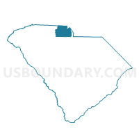
Outline

Summary
| Unique Area Identifier | 666963 |
| Name | McConnells Voting District |
| County | York County |
| State | South Carolina |
| Area (square miles) | 49.36 |
| Land Area (square miles) | 49.15 |
| Water Area (square miles) | 0.21 |
| % of Land Area | 99.57 |
| % of Water Area | 0.43 |
| Latitude of the Internal Point | 34.85623510 |
| Longtitude of the Internal Point | -81.25294420 |
Maps


Graphs
Select a template below for downloading or customizing gragh for McConnells Voting District, York County, South Carolina


Neighbors
Neighoring Voting District (by Name) Neighboring Voting District on the Map
- Bullocks Creek Voting District, York County, SC
- Delphia Voting District, York County, SC
- Lowrys Voting District, Chester County, SC
- Oak Ridge Voting District, York County, SC
- Ogden Voting District, York County, SC
- Sharon Voting District, York County, SC
- Wilksburg Voting District, Chester County, SC
Top 10 Neighboring County Subdivision (by Population) Neighboring County Subdivision on the Map
- Rock Hill CCD, York County, SC (111,223)
- Chester CCD, Chester County, SC (17,911)
- Hickory Grove CCD, York County, SC (4,492)
- McConnells CCD, York County, SC (3,975)
- Chester West CCD, Chester County, SC (3,278)
Top 10 Neighboring Place (by Population) Neighboring Place on the Map
Top 10 Neighboring Unified School District (by Population) Neighboring Unified School District on the Map
- York School District 3, SC (110,728)
- Chester County School District, SC (33,140)
- York School District 1, SC (31,112)
Top 10 Neighboring State Legislative District Lower Chamber (by Population) Neighboring State Legislative District Lower Chamber on the Map
Top 10 Neighboring State Legislative District Upper Chamber (by Population) Neighboring State Legislative District Upper Chamber on the Map
- State Senate District 15, SC (122,748)
- State Senate District 14, SC (98,937)
- State Senate District 17, SC (88,026)
Top 10 Neighboring 111th Congressional District (by Population) Neighboring 111th Congressional District on the Map
Top 10 Neighboring Census Tract (by Population) Neighboring Census Tract on the Map
- Census Tract 614.03, York County, SC (4,937)
- Census Tract 613.02, York County, SC (4,878)
- Census Tract 619, York County, SC (4,492)
- Census Tract 614.01, York County, SC (3,975)
- Census Tract 205, Chester County, SC (3,278)
- Census Tract 204, Chester County, SC (2,503)
Top 10 Neighboring 5-Digit ZIP Code Tabulation Area (by Population) Neighboring 5-Digit ZIP Code Tabulation Area on the Map
- 29732, SC (53,781)
- 29730, SC (52,365)
- 29745, SC (28,919)
- 29706, SC (19,847)
- 29742, SC (2,460)
- 29726, SC (1,750)